GARMIN BLUECHART CARTOGRAPHIE MARINE GPS - 2010 - EUROPE
movies, software, shows...
Files
| HXRU001R - Russian Inland Waterways,GMAPSUPP.img | 45.96 MB | ||
| HXRU001R - Russian Inland Waterways,HXRU001R - Russian Inland Waterways.jpg?042148 | 113.56 KB | ||
| VEU012R - Italy West Coast,Europe VEU012-016.jpg?042148 | 43.38 KB | ||
| VEU012R - Italy West Coast,GMAPSUPP.IMG | 923.52 MB | ||
| VEU014R - Italy, Adriatic Sea,Europe VEU012-016.jpg?042148 | 43.38 KB | ||
| VEU014R - Italy, Adriatic Sea,GMAPSUPP.IMG | 1.19 GB | ||
| VEU015R - Aegean Sea and Sea of Marmara,Europe VEU012-016.jpg?042148 | 43.38 KB | ||
| VEU015R - Aegean Sea and Sea of Marmara,GMAPSUPP.IMG | 1.13 GB | ||
| VEU016R-Mediterranean Southeast,VEU016R-Mediterranean Southeast.jpg?042148 | 64.55 KB | ||
| VEU016R-Mediterranean Southeast,gmapsupp.img | 488.99 MB | ||
| VEU021R - Denmark East and Sweden Southeast,GMAPSUPP.IMG | 769.08 MB | ||
| VEU021R - Denmark East and Sweden Southeast,VEU021R - Denmark East and Sweden Southeast.jpg?042148 | 40.59 KB | ||
| VEU042R - Oslo to Trelleborg,GMAPSUPP.IMG | 769.91 MB | ||
| VEU042R - Oslo to Trelleborg,VEU042.png | 542.16 KB | ||
| VEU047R - Gulf of Bothnia - Kalix to Grisslehamn,GMAPSUPP.IMG | 679.22 MB | ||
| VEU047R - Gulf of Bothnia - Kalix to Grisslehamn,Northern Europe VEU047-050.bmp | 405.97 KB | ||
| VEU049R - Stockholm to Aland and Turku,GMAPSUPP.IMG | 586.81 MB | ||
| VEU049R - Stockholm to Aland and Turku,Northern Europe VEU047-050.bmp | 405.97 KB | ||
| VEU050R - Aland to Vyborg,Europe VEU450-490.jpg?042148 | 40.41 KB | ||
| VEU050R - Aland to Vyborg,GMAPSUPP.IMG | 334.26 MB | ||
| VEU050R - Aland to Vyborg,Northern Europe VEU047-050.bmp | 405.97 KB | ||
| VEU055R - Finnish Lakes,VEU055R - Finnish Lakes.jpg?042148 | 68.74 KB | ||
| VEU055R - Finnish Lakes,gmapsupp.IMG | 859.47 MB | ||
| VEU057R - St. Petersburg to Rugen,Europe VEU450-490.jpg?042148 | 40.41 KB | ||
| VEU057R - St. Petersburg to Rugen,GMAPSUPP.IMG | 636.72 MB | ||
| VEU452S - Adriatic Sea, North Coast,GMAPSUPP.IMG | 732.3 MB | ||
| VEU452S - Adriatic Sea, North Coast,VEU452S - Adriatic Sea, North Coast.jpg?042148 | 37.98 KB | ||
| VEU453S - Adriatic Sea, South Coast,GMAPSUPP.IMG | 502.02 MB | ||
| VEU453S - Adriatic Sea, South Coast,VEU453S - Adriatic Sea, South Coast.jpg?042148 | 30.84 KB | ||
| VEU454S - Barcelona and Valencia,GMAPSUPP.IMG | 388.98 MB | ||
| VEU454S - Barcelona and Valencia,VEU454S - Barcelona and Valencia.jpg?042148 | 174.94 KB | ||
| VEU470S - Stromstad to Halmstad,GMAPSUPP.IMG | 421.1 MB | ||
| VEU470S - Stromstad to Halmstad,Nordics-VEU469-492.bmp | 483.72 KB | ||
| VEU477S - Iceland West,GMAPSUPP.IMG | 221.91 MB | ||
| VEU477S - Iceland West,Nordics-VEU469-492.bmp | 483.72 KB | ||
| VEU478S - Iceland East,GMAPSUPP.IMG | 222.88 MB | ||
| VEU478S - Iceland East,Nordics-VEU469-492.bmp | 483.72 KB | ||
| VEU503S - Lake Ladoga and Onega,GMAPSUPP.IMG | 229.86 MB | ||
| VEU503S - Lake Ladoga and Onega,VEU503S - Lake Ladoga and Onega.jpg?042148 | 15.37 KB | ||
| VEU504S - Black and Caspian Sea,GMAPSUPP.IMG | 1.55 GB | ||
| VEU504S - Black and Caspian Sea,VEU504S - Black and Caspian Sea.jpg?042148 | 46.69 KB | ||
| VEU505S - Baltic Sea, East Coast,GMAPSUPP.IMG | 385.92 MB | ||
| VEU704L - France,Europe VEU704,706,710.bmp | 710.07 KB | ||
| VEU704L - France,GMAPSUPP.IMG | 901.47 MB | ||
| VEU706L - UK & Ireland,Europe VEU704,706,710.bmp | 710.07 KB | ||
| VEU706L - UK & Ireland,GMAPSUPP.IMG | 1.89 GB | ||
| VEU708L - North Norway,GMAPSUPP.IMG | 1.23 GB | ||
| VEU708L - North Norway,VEU708L - North Norway.jpeg | 40.48 KB | ||
| VEU709L - South Norway,GMAPSUPP.IMG | 1.72 GB | ||
| VEU709L - South Norway,VEU709L - South Norway.jpg?042148 | 27.04 KB | ||
| VEU710L - Denmark, Skagerrak & Kattegat,Europe VEU704,706,710.bmp | 710.07 KB | ||
| VEU710L - Denmark, Skagerrak & Kattegat,GMAPSUPP.IMG | 1.33 GB | ||
| VEU711L - Sweden South,GMAPSUPP.IMG | 1.62 GB | ||
| VEU711L - Sweden South,Northern Europe VEU710-720.bmp | 450.05 KB | ||
| VEU713L - Finland Gulfs Bothnia and Finland + Inland lakes,BlueChart g2 Finland.jpg?042148 | 245.18 KB | ||
| VEU713L - Finland Gulfs Bothnia and Finland + Inland lakes,Northern Europe VEU710-720.bmp | 450.05 KB | ||
| VEU713L - Finland Gulfs Bothnia and Finland + Inland lakes,gmapsupp.img | 1.81 GB | ||
| VEU714L - Iberian Pen.-Azores-Canaries,Mediterranean VEU714-716.jpg?042148 | 27.33 KB | ||
| VEU714L - Iberian Pen.-Azores-Canaries,VEU714L - Iberian Pen.-Azores-Canaries v2011.5 v13.jpg?042148 | 138.24 KB | ||
| VEU714L - Iberian Pen.-Azores-Canaries,gmapsupp.IMG | 2.25 GB | ||
| VEU717L - East Mediterranean & Black Sea 2014.0 (15.50),Mediterranean VEU717.jpg?042148 | 23.76 KB | ||
| VEU717L - East Mediterranean & Black Sea 2014.0 (15.50),VEU717L-East Mediterranea & Black Sea 2014.0 (v15.50).jpg?042148 | 895 KB | ||
| VEU717L - East Mediterranean & Black Sea 2014.0 (15.50),VEU717L.txt | 1.88 KB | ||
| VEU717L - East Mediterranean & Black Sea 2014.0 (15.50),gmapsupp.img | 3.45 GB | ||
| ▲ 64 total files | |||
Description
Cartes Garmin BlueChart SERIE G2
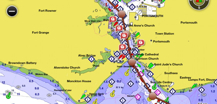
Ces cartes proposent un excellent niveau de précision et de détail, comparable à la cartographie papier. Les cartes G2 intègrent toutes les informations utiles à la navigation (secteur de feux, balisages, points de sonde, courbes de profondeurs, épaves, zones de mouillage…) ainsi que des cartes de pêche détaillées incluant les courbes bathymétriques.
Cartes de navigation détaillées
Affichage 2D ou 3D plane
Aides à la navigation (épaves, obstacles, mouillages réglementés…)
Affichage personnalisable des contours de profondeurs
Plans de ports, zones intertidales
Points de sonde
Stations de marée (annuaire des marées et graphiques)
Cartes de pêche détaillées
Points d’intérêts marins (marinas, ports, rampes de mise à l’eau)
Ces cartes sont compatibles avec tous les Garmin pour utilisation marine, ainsi que les NUVI 500 et 550.
Collection de cartes pour la plupart du globe - télécharger toutes ou seulement celles qui vous intéressent (mais SVP rester en partage).
INSTRUCTIONS POUR NUVI 500 et NUVI 550
Copier le fichier gmapsupp.img souhaité dans le repertoire Garmin d'une memoire externe SD. Ne pas changer de nom. Seulement un fichier cartographique par mémoire.
Ce torrent: EUROPE EN 31 CARTES
Europe
HXRU001R - Russian Inland Waterways
VEU012R Italy West Coast
VEU014R Italy, Adriatic Sea
VEU015R Aegean Sea and Sea of Marmara
VEU016R-Mediterranean Southeast
VEU021R Denmark East and Sweden Southeast
VEU042R Oslo to Trelleborg
VEU047R Gulf of Bothnia - Kalix to Grisslehamn
VEU049R Stockholm to Aland and Turku
VEU050R Aland to Vyborg
VEU055R Finnish Lakes
VEU057R St. Petersburg to Rugen
VEU452S Adriatic Sea, North Coast
VEU453S Adriatic Sea, South Coast
VEU454S Barcelona and Valencia
VEU470S Stromstad to Halmstad
VEU477S Iceland West
VEU478S Iceland East
VEU503S Lake Ladoga and Onega
VEU504S Black and Caspian Sea
VEU505S Baltic Sea, East Coast
VEU704L France
VEU706L UK & Ireland
VEU708L North Norway
VEU709L South Norway
VEU710L Denmark, Skagerrak & Kattegat
VEU711L Sweden South
VEU712L Sweden East
VEU713L Finland Gulfs Bothnia and Finland + Inland lakes
VEU714L Iberian Pen.-Azores-Canaries
VEU717L East Mediterranean & Black Sea
COMPATIBILITÉ
Ces cartes sont compatibles avec les familles de produit Garmin suivantes:
Astro, Colorado, D2, Dakota, Descent, ECHOMAP, epix, eTrex, f?nix, GPSMAP, Montana, Monterra, nüvi (seulement 500 et 550), Oregon, Panoptix, Rino, tactix
Related Torrents
| torrent name | size | uploader | age | seed | leech |
|---|---|---|---|---|---|
|
Garmin BlueChart g2 HEU801X - Europe-NW Atlantic-Iberian Pen v14.50 UNLOCKED Posted by
Choufdar in Apps
> Other Applications
|
809.94 MB | Choufdar | 4 months | 2 | 0 |
|
GARMIN BLUECHART CARTOGRAPHIE MARINE GPS - 2010 - LES AMERIQUES Posted by
Hrund in Apps
> Other Applications
|
16.61 GB | Hrund | 7 years | 1 | 0 |
| 8.23 GB | Hrund | 7 years | 0 | 1 |
All Comments